Integrated Drone-Based Geophysical Exploration for Smarter Mining Decisions
Who We Are in One Glance...
Founded in 2019, Air Information Solutions is one of the first Saudi companies specialized in integrated drone-based geophysical exploration. We support mining, environment, infrastructure, and natural resource sectors through advanced scientific and digital solutions.
Highlights
1
Saudi-Based Expertise
2
Drone + AI + Geophysics
3
End-to-End Exploration
4
Vision 2030 Aligned
Why Clients Choose AIS?
Faster Exploration
Surveys completed in days instead of months.
Lower Costs
Drone-based operations reduce field costs significantly.
High-Resolution Data
Accurate outputs for confident technical decisions.
Safer Operations
Reduced field exposure and zero-risk aerial acquisition.
Integrated Workflow
From screening to mine development in one system.
Sustainable Approach
ESG-aware exploration with reduced environmental footprint.
Exploration Workflow Preview
Highlight your history, showcase growth and key milestones.
Regional Screening
• Satellite Remote Sensing
• AI Mineral Prospectivity
• Target Area Identification
Ground Investigation
• ERT, IP, EM & Ground Magnetic Surveys
• Subsurface Characterization
• High-Accuracy Ground Data Acquisition
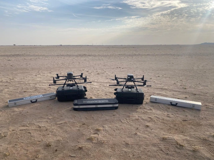
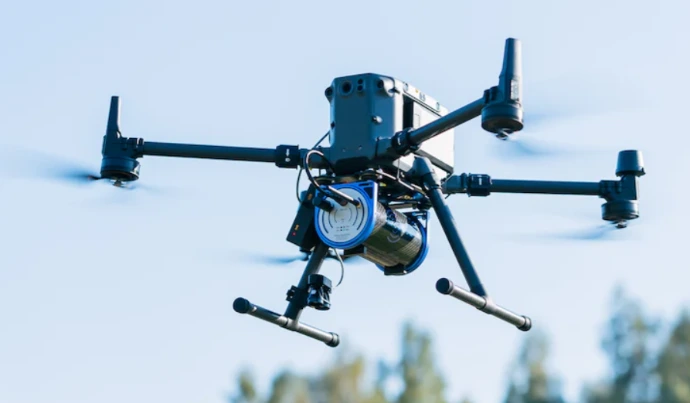
Airborne Survey
• UAV Magnetic Survey (MagDrone)
• UAV Photogrammetry (Orthomosaic + DEM)
• High-Resolution Geophysical Data
Geological & Geochemical
• Geological Mapping
• Geochemical Sampling
• Mineral System Analysis
Laboratory Validation
• Thin Section & Sample Preparation
• Petrographic Analysis
• Mineral Confirmation
3D Modeling & AI
• 3D Geological Modeling
• AI Data Integration
• Drill Target Generation
Drilling & Validation
• Drill Program Design & Supervision
• Downhole Geophysics Logging
• Ore Confirmation & QA/QC
Resource Estimation
• Block Modeling
• Resource Estimation (JORC / NI 43-101)
• Bankable Asset Definition
Mine Development
• Open Pit & Underground Design
• Production Planning
• Economic Evaluation
Governance, Risk & Sustainability
• ESG Reporting
• Mining Risk Assessment
• Environmental Compliance & Investment Readiness
Monitoring & ESG
• UAV Monitoring
• Digital Twin
• Real-time Dashboard
Technologies & Platforms
Technology That Powers Smarter Exploration
01
Smart Flight Systems
02
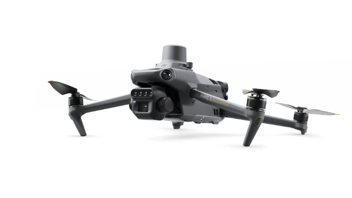
Advanced Sensors
03

Intelligent Analytics
04
![]()
Integration & Quality
This program demonstrates the capability of AIS to combine airborne, ground geophysics, and digital platforms within one integrated workflow. The result is better subsurface understanding, reduced exploration risk, and faster, more confident decision-making.
Frequently Asked Questions about Mining Operations
Find quick answers to common questions about our mining services, and projects.
Drone-based exploration significantly reduces survey time compared to traditional field methods. By combining aerial geophysics, remote sensing, and digital data platforms, projects can move faster from target identification to decision-making with greater operational efficiency.
Air Information Solutions provides high-resolution exploration data including UAV magnetic surveys, photogrammetry, DEM models, geophysical interpretations, anomaly maps, and integrated 3D geological models. These outputs help clients better understand subsurface conditions and make informed technical decisions.
Yes. Our integrated workflow reduces reliance on heavy ground operations, minimizes field exposure, lowers environmental impact, and supports ESG reporting and risk assessment. This allows mining projects to be executed with higher safety standards and stronger sustainability alignment.